CLIMATE ALERT
super el niño is back in focus
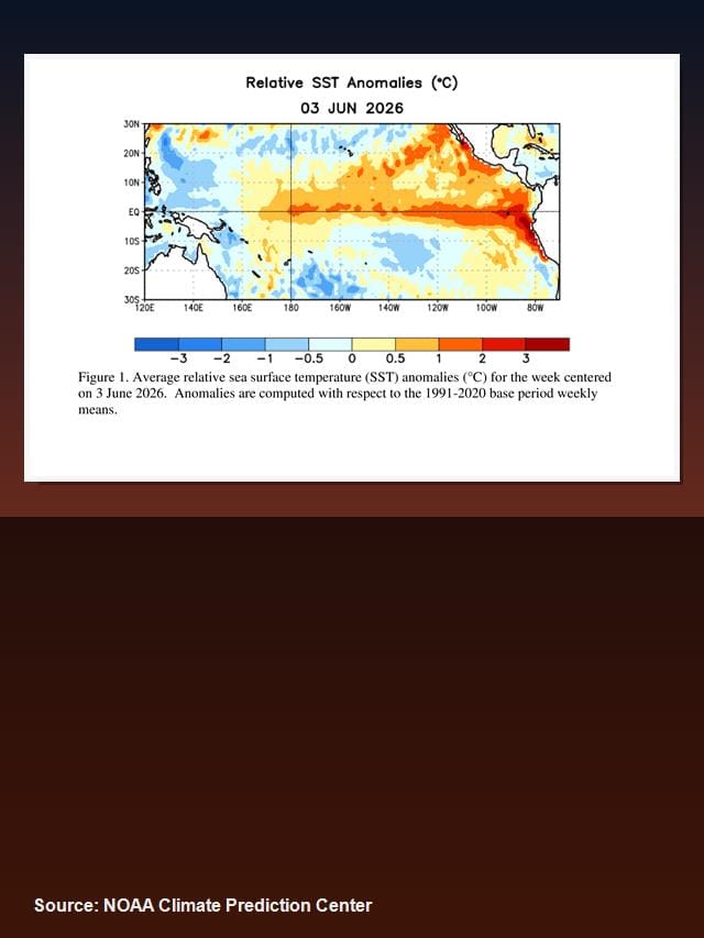
NOAA says El Niño conditions are present and expected to strengthen into winter 2026-27.
WHAT IT MEANS
Warm Pacific waters drive the story
El Niño starts when unusually warm water builds across the central and eastern tropical Pacific.
WHY SUPER MATTERS
A very strong event is possible
NOAA lists a 63% chance of a very strong El Niño during November-January.
U.S. IMPACT
The South may turn wetter
Strong El Niño patterns often tilt winter rainfall odds toward the southern United States.
GLOBAL SIGNAL
Heat can shift weather worldwide
A powerful El Niño can influence drought, floods, storms, agriculture and ocean ecosystems.
OCEAN HEAT
Subsurface warmth is a key clue
NOAA notes above-average subsurface temperatures remained in the central and eastern Pacific.
FORECAST MODELS
Winter is the main window
Model guidance points to strengthening during the Northern Hemisphere winter of 2026-27.
NOT EVERYWHERE
Impacts are never identical
Even very strong El Niño events do not produce the same weather outcome in every region.
PREPARE EARLY
Forecasts help reduce risk
Cities, farmers and emergency managers use ENSO outlooks to plan for seasonal extremes.
BOTTOM LINE
Watch the Pacific, not the hype
The phrase super el niño is dramatic, but NOAA data is the best guide for what comes next.